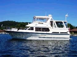
Bright and early (for us) we had all our cords and ropes ready to move at 7:40 a.m. for points north. I had put routes in the Garmin that would take us about 55 miles up the Bay to Chesapeake City, MD on the C & D Canal where we plan to stop for the night and on to Delaware City another 20 miles or so.
 |
| Interesting Air Lift |
As we started through the harbor we heard this helicopter starting to lift something off the land on our port side..
 |
| Police Boat |
Then 3 of these cute little police boats with light flashing came into view. Apparently they were going to stop boat traffic until the helicopter cleared the waterway. This one told us to hurry on through the area which has a speed limit of 6 mph so we bumped it up to 7.5 mph and the next cop told us to slow down. Go figure!
 |
| Cargo Ship on C & D Canal |
Shortly after noon we entered the C & D Canal. The canal is monitored by TV cameras in many places and has a signal at each end if it is safe to enter. They do not allow sailing, water skiing or tubing on the canal cause these big guys show up really quickly. The small boat on the port side is retrieving the port captain that got on the boat as it entered from the Delaware River.
Chesapeake City Docks are just past this bridge and since we were making good time decided to go on to Delaware City.
 |
| C & D Canal |
The actual canal is 14 miles long and about 500 feet wide.
 |
| Railroad Lift Bridge |
The railroad bridge is normally up unless a train is coming.We have now left MD and entered DE.
 |
| Last 2 Bridges on Canal |
Tide runs around 5 feet in this area and we were running against a 3 mph current making travel pretty slow.
 |
| Delaware River Current |
We thought the current on the canal was tough ... we had to run 2200 RPM on the Delaware River to move 8 mph upstream for 2 miles to the branch cut for the marina.
 |
| Our Marina |
The marina is a series of 4 long docks along the side of the water.
 |
| Turning into the pump out station |
We needed to get a pump out and with a very strong strong current, we had to put the stern upstream on the dock next to the pilings which was not a very big hole. Then we moved to our permanent spot right behind Moor $tuff at the downstream end of the docks. Skip & Barb welcomed us and we had a nice evening chatting.
Looks like the next several days are going to be snotty so we probably won't move to Cape May until late in the week. That will give us time to provision since Skip has his car here plus do a few chores on the boat.
Our travel today was 76 miles and we got here just after 4 p.m. This is the most miles we have had since last year going from Marco Island to the Keys.
Our position here is N 39 34.300 W 075 35.415


No comments:
Post a Comment