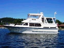
Quest

Quest

Tuesday, September 11, 2012

Inland Marina, Evansville, IN - 9/10/12

Yesterday we did not have a signal to post our blog so here are both days.

We departed Golconda at 6:45 after filling up with 196 gallons of fuel @ $4.89 (ouch).

Hole in the Cave

Nice Ride
 A very nice ride up the Ohio River for 111 miles.

American Queen

As we rounded a corner there came this monster boat.

Evansville
 We got to Evansville at 5:45.

Evansville Water Front


Marina Harbor Entrance
 The marina was already closed but since I had called earlier and paid our dockage of $1 per foot with a credit card, we were assigned space tied to the restaurant just inside the harbor where we had dinner before retiring to an evening of relaxation.

Old Navy Boat
This ship is just north of the entrance to the harbor and is the one that retired Navy guys take it around on display.  It was in Marietta a few years ago during the Stern Wheel Festival.

Tomorrow our run is only about 80 miles but it is a set up for a long 125 mile run the next day because there are no marina facilities in that stretch and we don't want to anchor in the Ohio.

N 37  57.201   W 087  34.554

Golconda Marina, Golconda, IL - 9/9/12


Sunrise on the Mississippi
 We pulled our anchors (bow and stern) at 6:15 and followed Bobbi Two out of the towhead on the Mississippi and turned the corner onto the Ohio River for our 80 mile trip today up the river.

New Lock on the Ohio
 The very noticeable change in current hit us on the nose.  Now we are going 2,000 rpms and getting only 9 mph.  This area is very busy with tows and we had to thread our way through.  We are to meet up with Blue Heron around 8 a.m. at the new Olmsted Lock that is being built where they anchored last night.
 
Blue Heron

Bobbi Two

Lock 52 Raft Up
 Lock 52 is just a mile or so from the new site and we were through inside half an hour.  This was a very old and rustic lock with less than 100 feet of flat wall so we had to raft all 3 boats together.

Inside Lock 52

Raft
 Craig had already called lock 53 which is known to be slow to see when we could lock through and was told that if we could make the 20 plus miles by noon and it was now 10 a.m. we would go through.  So we all took off but our boat being full displacement was much slower than the other two plus we were starting to show signs of needing to change fuel filters.

Leaving 52
A tow had pulled up to the doors so we had a very small hole to get through.

 The other two boats made it to the lock by noon and we got there about 12:15 but the tow coming out was still inside the lock and we didn’t get through until 1:30.  At least 20 tows were waiting to lock through on each side of the river.  A little known fact about federal locks … if pleasure craft are at a lock they will be locked through after 3 commercial lockages.

The other two boats left me and headed for Green Turtle Bay on the Cumberland and we proceeded north on the Ohio toward our destination.  

Cumberland River Exit
 When we got to the Cumberland River intersection, we officially crossed our wake and had to perform the ceremony of releasing our two passengers into the water plus change our worn looper flag to the gold one which signifies that we have completed the circumnavigation of the east coast.
 
Goodbye Don

Goodbye Darrin

Hang the Gold

Still with Elliott

Ricki and Elliott

We still had one lock and about 30 miles to go to Golconda Marina and arrived after they closed at 6:05 and assumed our assigned spot on A Dock.  We will pay them and get fuel tomorrow morning when they open at 6 a.m.

Tomorrow our destination is about 112 miles upriver but we do have a plan B if we get held up at the one lock we need to go through.

N 37  22.190  W 088  28.920

Sunday, September 9, 2012

Cairo, IL, Angelo Towhead Anchorage - 9/8/12

Our plan today was to try and get 158 miles to the mouth of the Ohio River since we lost a day yesterday due to the storms.  We pulled our cords and lines at 6:20 a.m. (first light) and took off south.  A 70 ft Hatteras that was in front of us on the dock left next followed by Blue Heron an hour or so later.

Mississippi River
 The 70 footer caught us early and passed us.  Blue Heron caught us about 50 miles down the river and passed us.  We did not see another pleasure boat or fishing boat the rest of the day.

WOW ... 16.1 mph
 We were running at 1,900 rpms that would normally move us along at 12 mph but with the current pushing us we averaged between 13.5 and 14 mph with bursts of 15 mph or higher.

Mississippi River
 158 miles of seeing levies on the left and right so here is a picture of a rock.  This has to be the MOST boring piece of water on the whole loop.

Tow
 There are no locks on the river now so we saw some big tows.  Since the water is a little low passing them has to be with their consent and in a pretty straight stretch of water.

Will it make it just 60 more miles
 We will be replacing this worn thing with our Gold Flag when we cross our wake as we pass the Cumberland River route on the Ohio River.  This will also be the place that our passengers on the trip will get off. Perhaps you will remember that Ricki's brother Darrin always wanted to go with us so we have his ashes along with my friend and former commodore of BYC, Don Best who also dreamed of the trip so we will release their ashes when we cross our wake. When we get to that point we will have traveled 7,600 miles with still another 800 to get home.  We are now in "delivery mode" and want to do about 100 miles per day.

Nice Touch
We are anchored with Bobbi Too the 70 footer and will leave with them at daylight and head for the dreaded locks 52 and 53 on the Ohio.  We heard from one of our friends a few days ahead of us that waits up to 24 hours can be expected which will wreck our plans.

N 36  58.683   W 089  09.212

Saturday, September 8, 2012

Hoppie's Marina, Kimmswick, MO - 9/7/12

The sun was shinning and things looked good to leave this morning until we looked at the weather and saw the storm that was predicted for later in the day.  We discussed the options with Blue Heron and decided that we wanted to be securely tied to the dock as opposed to being caught either on the water or in an anchorage.

Hoppie's Marina

Hoppie's Marina
 The marina is very rustic but the folks here couldn't be more friendly.

 Once we decided to stay the next decision was where do we want to eat breakfast.  So we walked the 1/2 mile to town .....


Kimmswick

Breakfast
 And stopped at the ONLY restaurant in town and had a fantastic breakfast.

Paper Towels and Bread
We asked our server where we could get some bread and paper towels and was told that there was not a store in town but they would sell us some of theirs.  That's hospitality!!!


Kimmswick
After breakfast Ricki walked around town shopping in the several quaint stores while I went back to the boat to change oil in all three motors and fix a cranky front stateroom head.

City Hall

Shopping

The Storm
5:30 p.m. saw cocktails on Quest and then the storm hit.  So glad we did decide to stay put because it rained hard and the wind blew just as hard.  We spent some time under the dock roof talking with Fern and Hoppie about the plight of their marina with the river so low and the silting problem created by the Corp of Engineers by placing a wing dam close to the marina.

Tomorrow we have decided to leave at dawn and with a strong current try to make it 158 miles to the Ohio River to make up for the day we stayed here.

Friday, September 7, 2012

Hoppies Marina, Kimmswick, MO - 9/6/12

Finally ... we can get our air card to work and I have posted the last 3 days.

Kathy and Mike
 We are moving on today and leaving Mike and Kathy so we invited them to the boat for our farewell breakfast.  We have so enjoyed traveling with them these past few weeks and will miss their company.

Grafton Harbor
 We left Grafton at 8:30 a.m. and headed for Hoppies marina some 60 miles away.

Mississippi River (left) and Illinois River (right)
 Within the first half mile we entered the mighty Mississippi.

Along the Mississippi


Our Lady of the River
 This is a stature to honor their town not being destroyed by a big flood a few years ago.

House on the Hill
 I spotted this big home overlooking the river.

Passing Alton

Approaching Mel Price Lock
 As we were passing Alton about a mile from the dam I heard radio traffic between a work barge and the lock.  The lock master actually contacted the "big white personal water craft" heading toward the lock to see if we wanted to lock down with the barge.  This was a first since normally the boat must initiate the contact.

Sharing the Lock

Casino Boat

Repair Barge
 As we went further down stream we passed several interesting sights.

Chain of Rocks Canal
 A canal has been established to bypass the rapids in the river.

Approaching Chain of Rocks Lock
 We did not have to wait for the doors to open and went right in.  The lock master gave us permission to just float without tying to the wall since it was just a 12 foot drop.

Submerged Upstream Door

Door fully up

A real steam engine
 Approaching st. Louis we heard what sounded like a steam engine horn and then noticed it crossing the river.

New Bridge at St. Louis


River Debris
 The river has only shown us 12 to 14 foot levels most of the time with many readings around 9 feet.  As you can see it is really low.

Old Miss Current

The current has picked up and we went through St. Louis at 13 mph at 1400 rpms.

Quest at Hoppies
 We got to Hoppies Marina at 2:45 p.m. and with Fern's direction docked upstream in a very stiff current without incident. Only 2 looper boats are here, Quest and Blue Heron.

Hoppies Marina
 Hoppies is nothing more than a series of barge flats in the river. This is the only stop for the next 158 miles to the Ohio River.


Fern's Charting Party
 When loopers are at the marina, Fern always has a charting party where she gives us her experience on where to stop and places to watch as we go on down the river.

Another Storm
 A terrific storm passed through with very strong winds.  The TV said we had gust approaching 60 mph.

Barb and Craig (Blue Heron) with Fern
Tomorrow is supposed to have storms again but we will check in the morning to see if we will leave and go part way to the Ohio.

N 38  21.513   W 090  21.602